szeged, hungary
The construction of Szeged's third inner-city bridge has been on the agenda for at least a hundred years, but so far it has not been able to go beyond the conceptual design stage. I hope that this unique bridge, with its additional functions, will be a good example of how a bridge is not only a transport facility, but also a central public space of the city. I have ensured that the bridge and its connecting structures have a coherent style and look.
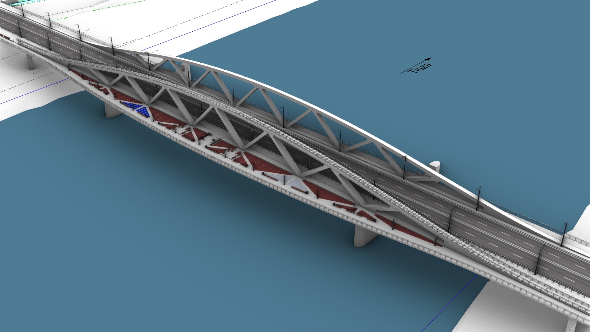
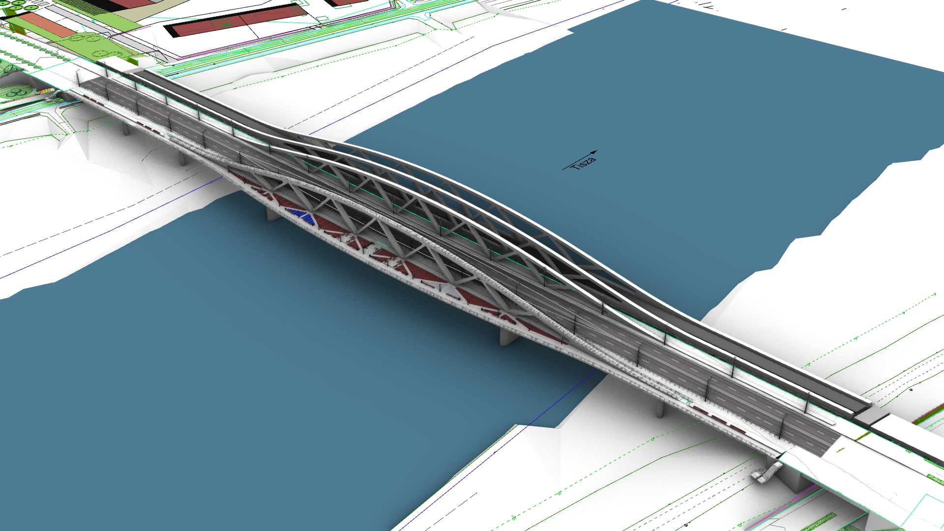
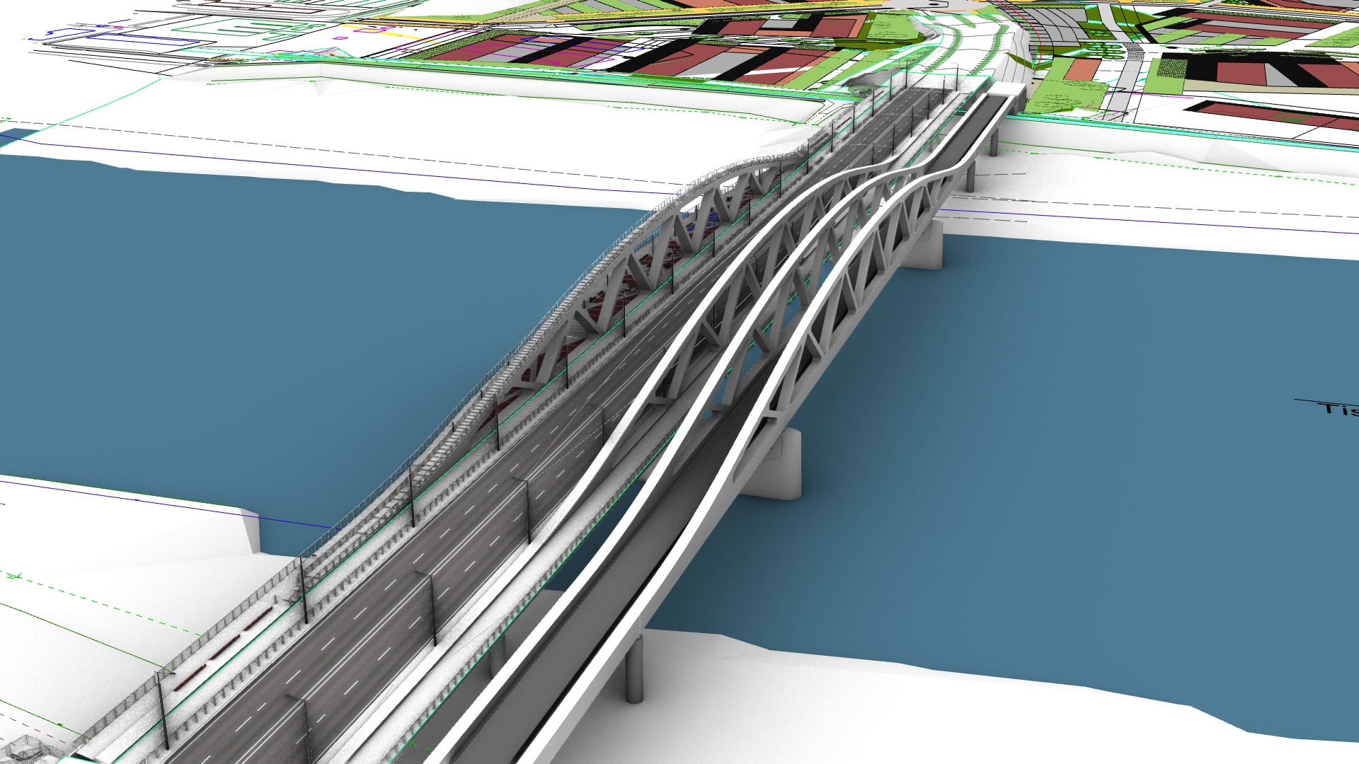
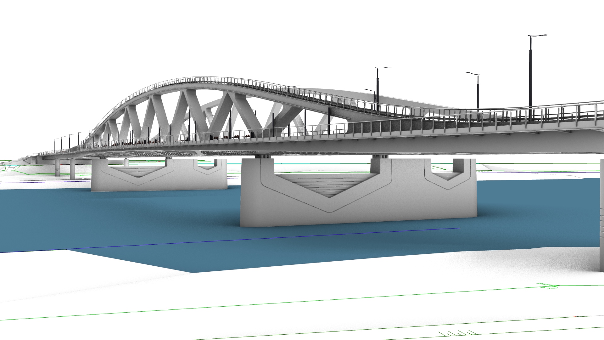
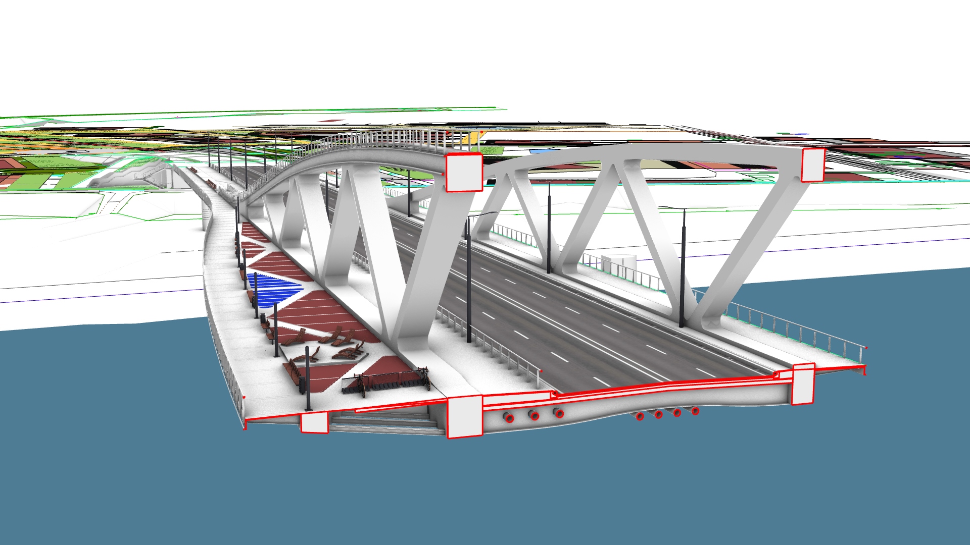
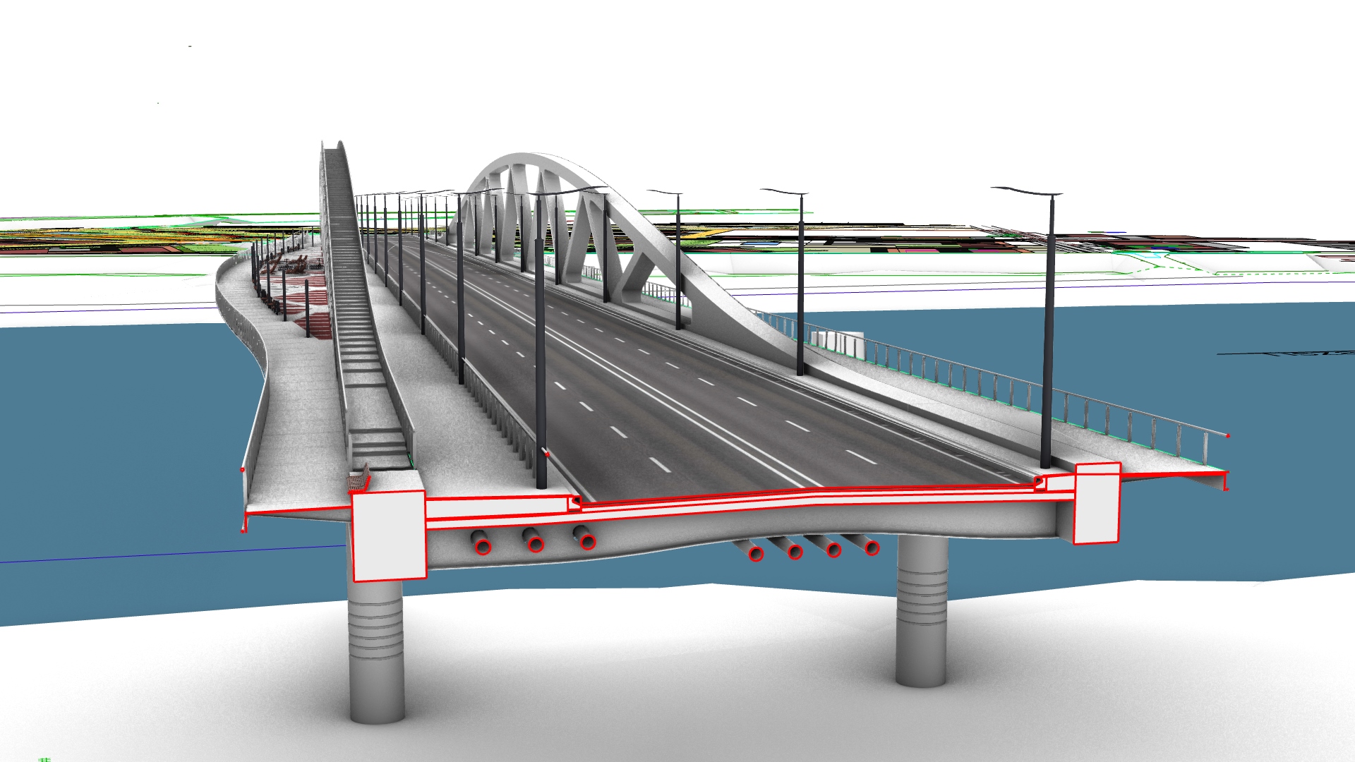
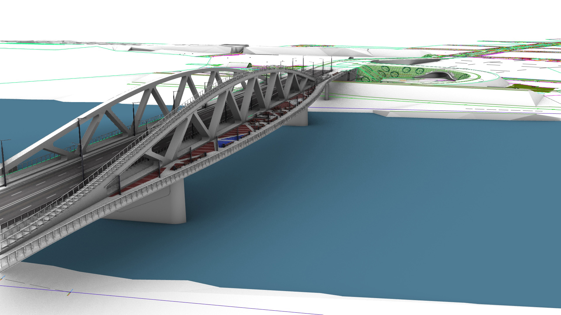
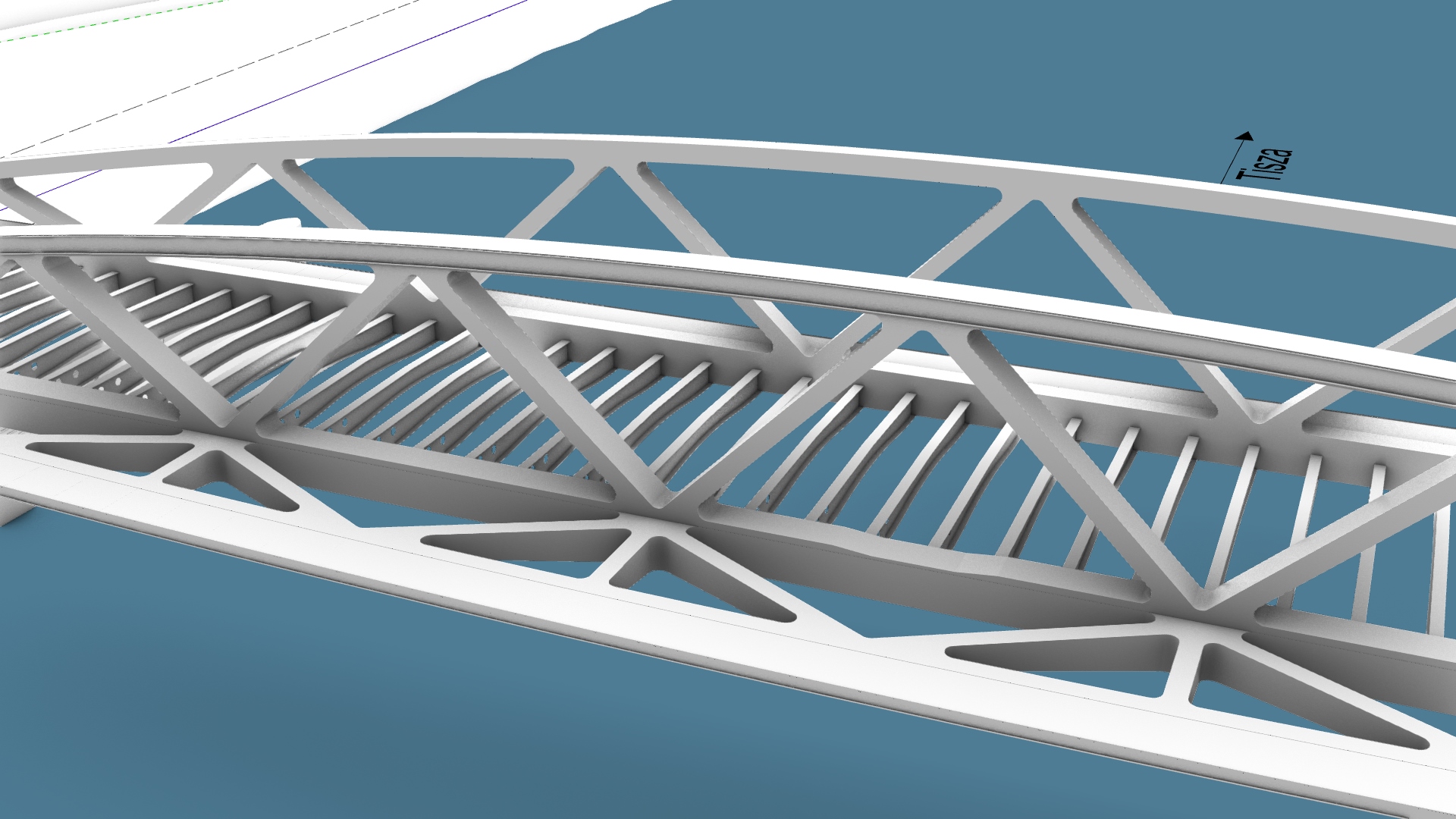
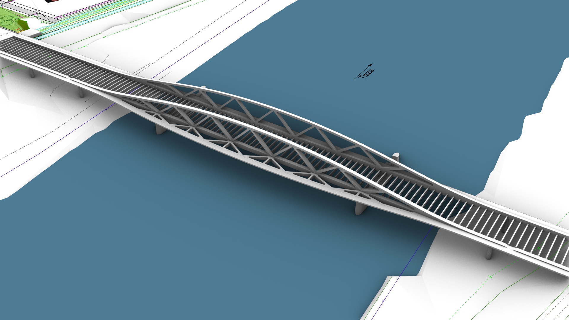
The entire bridge structure has three superstructures separated by expansion joints. The steel structure of the river bridge is wedged between the two single-span, prefabricated reinforced concrete beam bridges on either side. The middle bridge is a six-span, two-girder, lower-deck, continuous multi-support beam bridge, with a constant main girder height in the floodplain spans and a variable height Warren truss girder in the riverbed spans. The distance between the main girders and the width of the south/outflow side cantilever are constant along the entire length of the superstructure, while the north/inflow side cantilever has a variable width. In the centreline, the height difference between the road surface and the lower edge of the structure is constant, exactly 2.0 m.
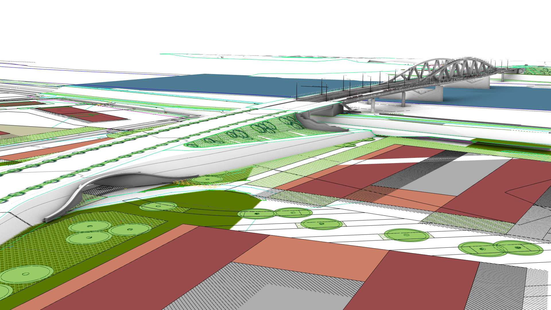
The floodplain piers are independent, while the riverbed piers and the abutments are common substructures for both the road and railway superstructures. The large, multi-storey reinforced concrete abutments are located on the protected side of the flood protection embankments.
The first span on the floodplain of the Szeged side is a two-girder, constant height, box-girder bridge, which continues in a three-span Warren truss bridge with a curved upper chord, then on the Újszeged side in a two-span, also two-girder, constant height, box-girder bridge.
Spans: 45.00 + 65.00 + 130.00 + 65.00 + 45.50 + 42.50 m
Length of superstructure: 395.00 m
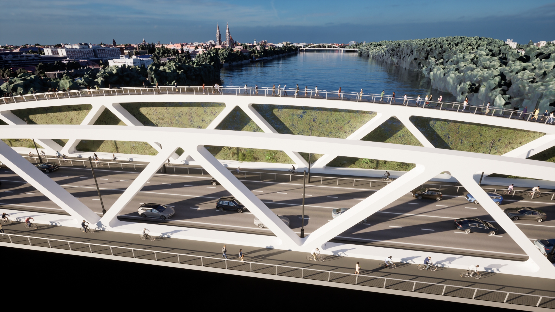
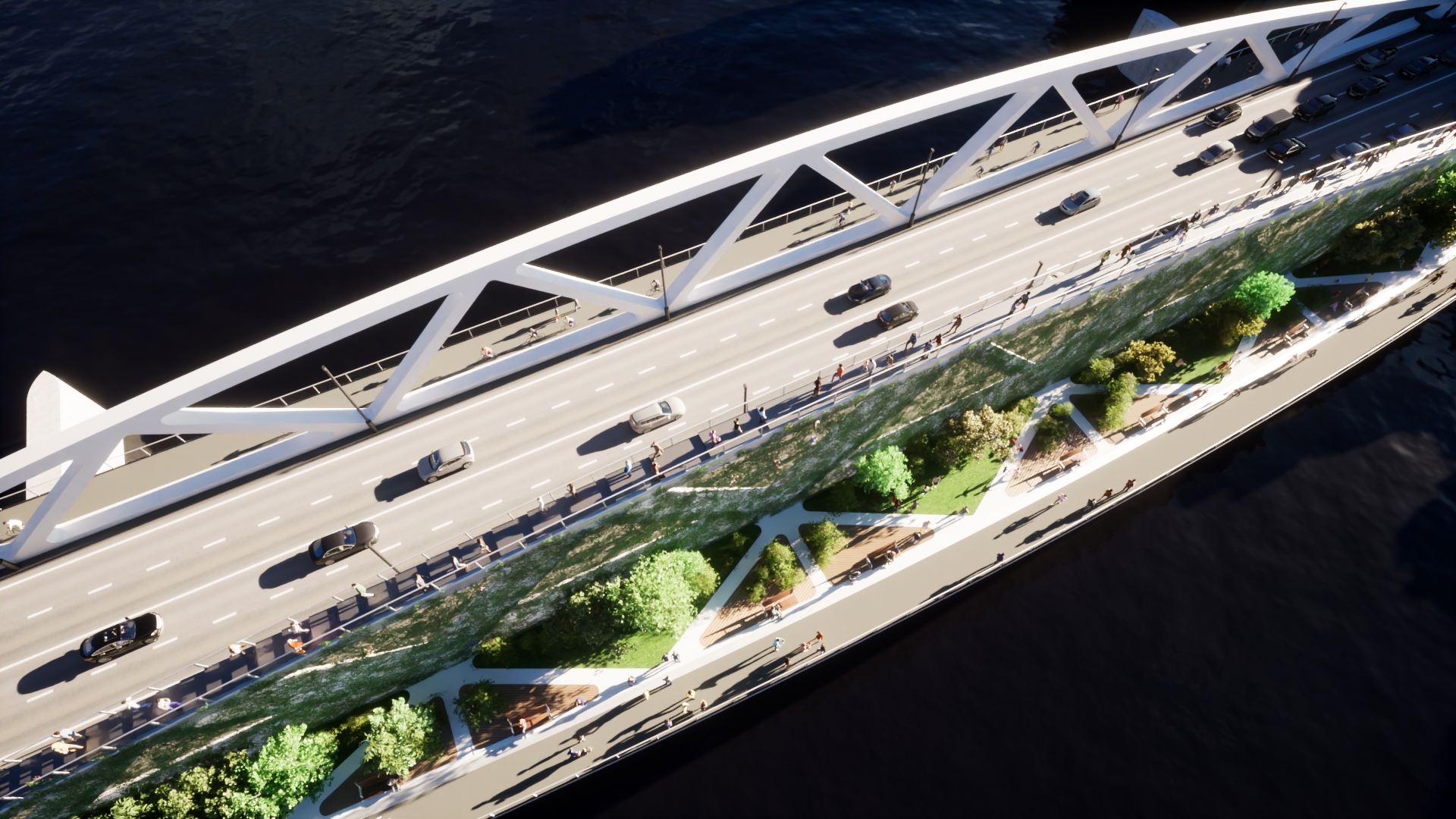
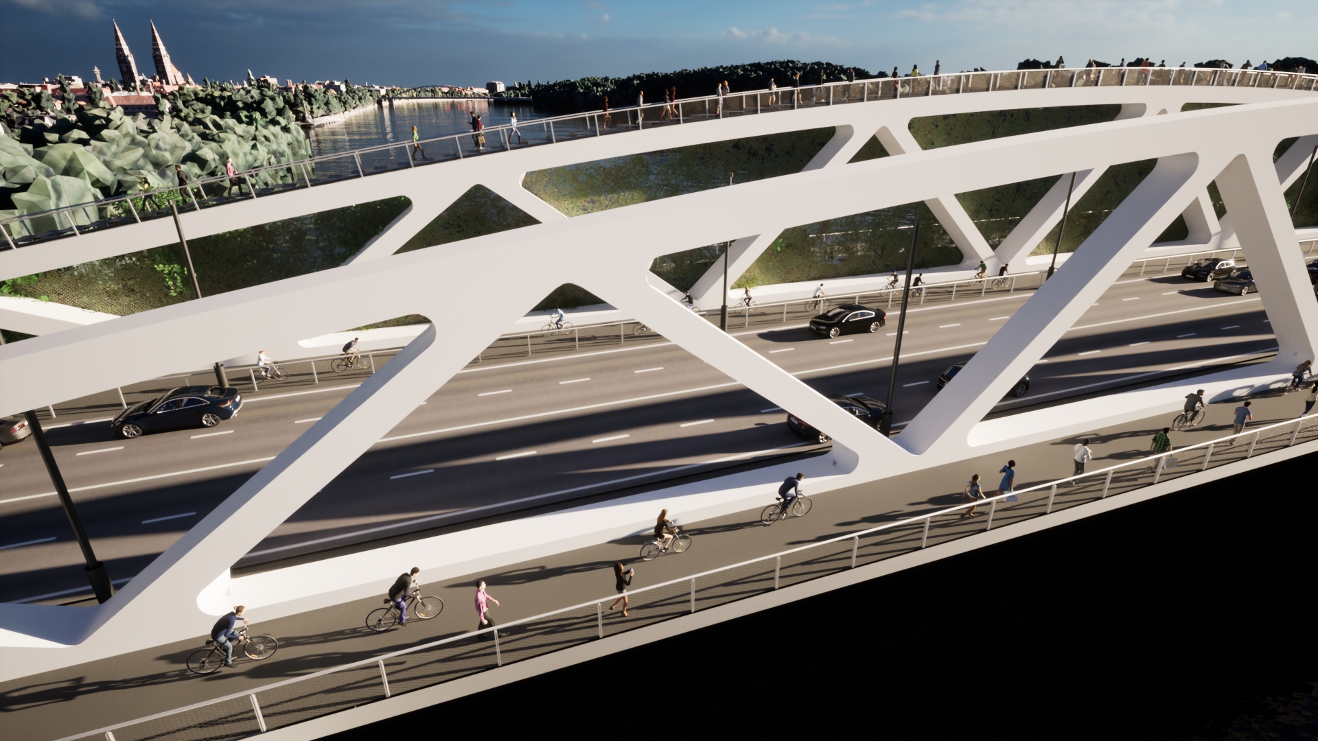
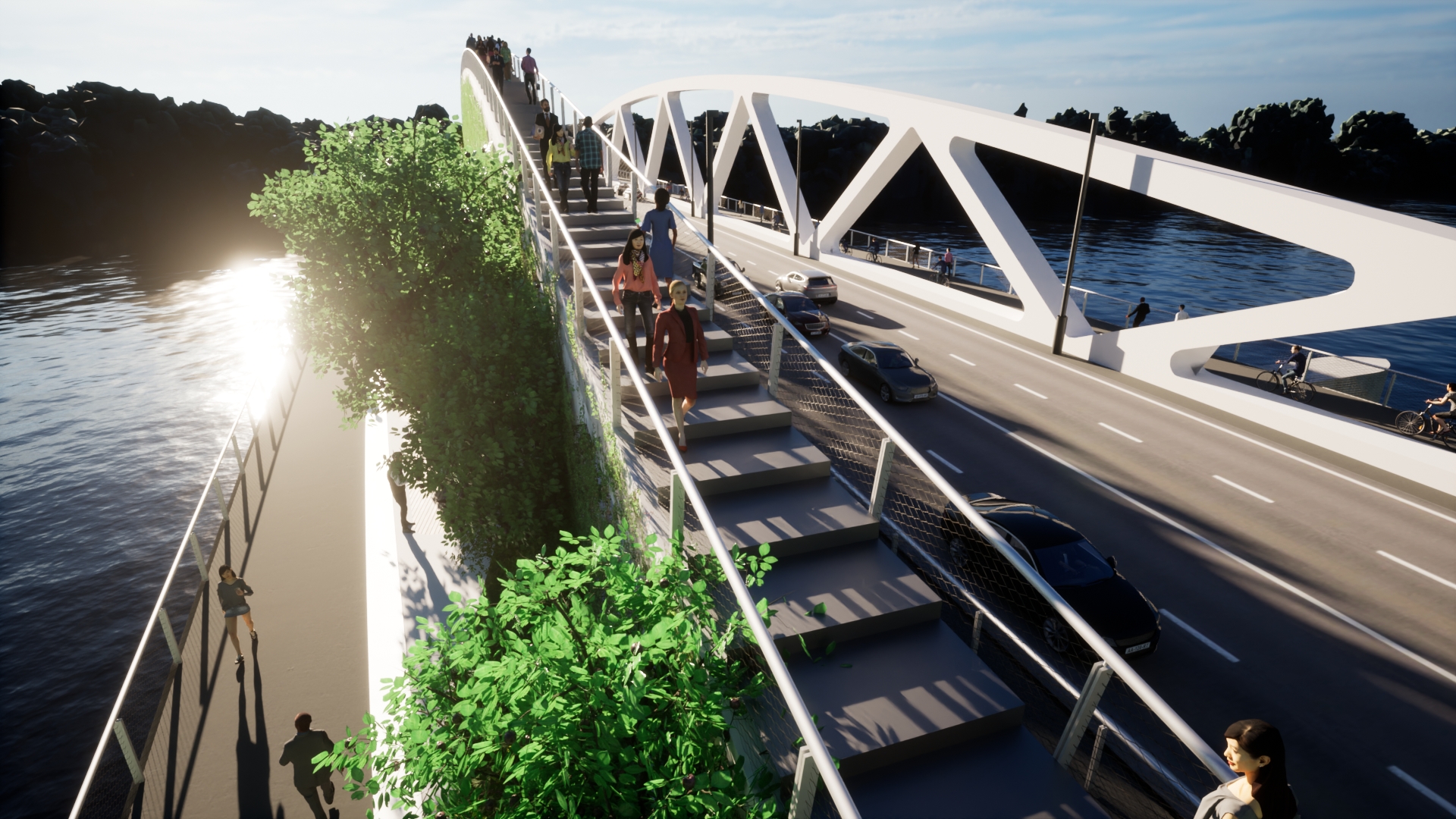
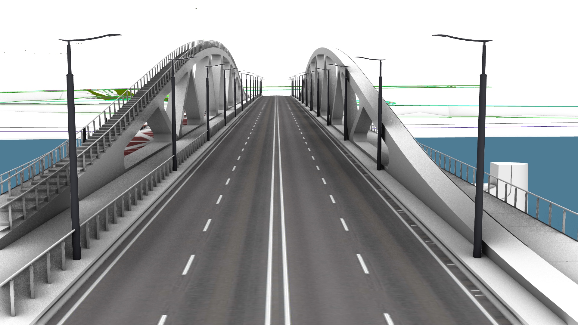
Between the main girders of the Warren truss, there are 2x2 traffic lanes and a two-way cycle lane. The traffic lanes are 3.25 m wide and the two-way cycle lane is 2.55 m wide. The total width between the main girders is 19.75 m. The area between the main girders has a reinforced concrete slab with a three-layer asphalt surface. The lane layout is symmetrical to the road axis, with a roof profile, a 2.5% side slope and a raised safety kerb.
The width of the cross-section varies, as the width of the terrace on the northern side of the curved Warren truss gradually changes in a sinusoidal pattern. The floodplain spans are 30.00 m wide, while the maximum width in the middle cross-section of the riverbed span is 38.00 m.
The southern cantilever is 3.75 m wide with a 3.6 m wide separated one-way cycle lane and footpath. Similar to the northern cantilever, the deck has a 2% outward slope. It is covered with 3.0 cm thick moulded asphalt.
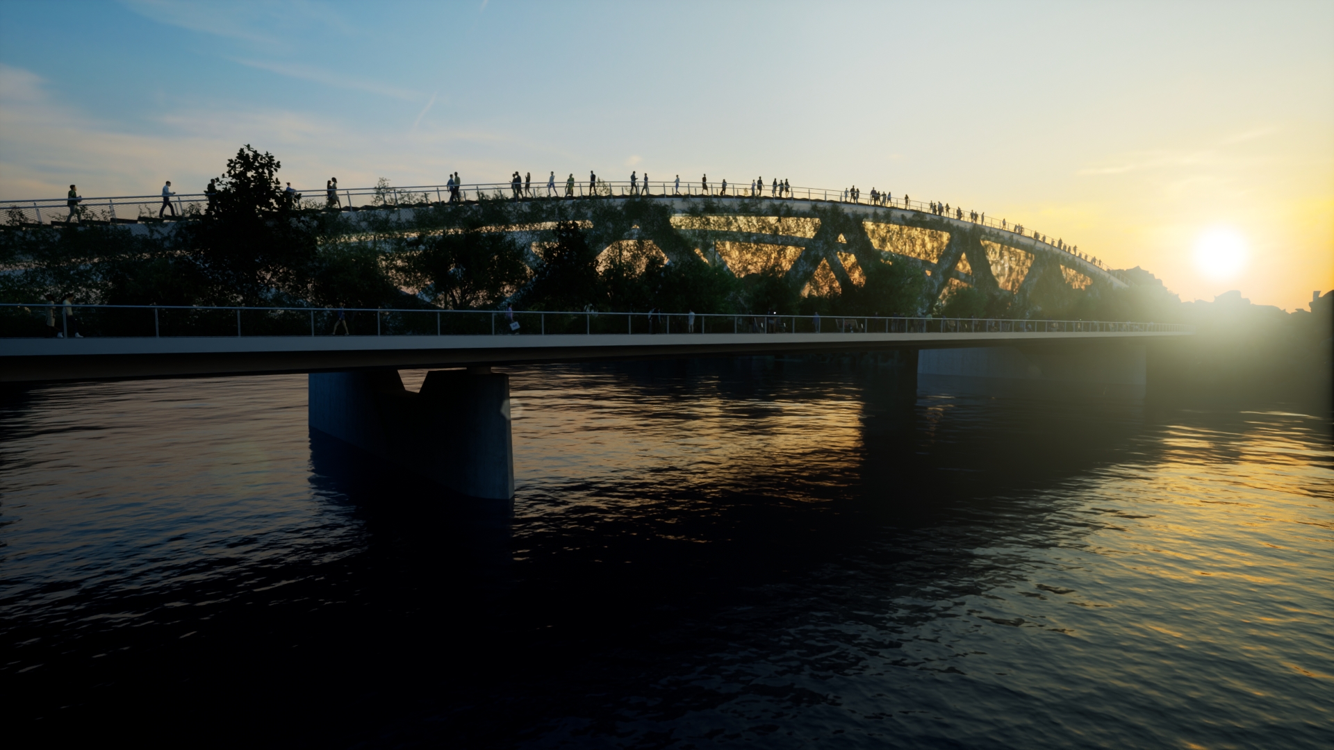
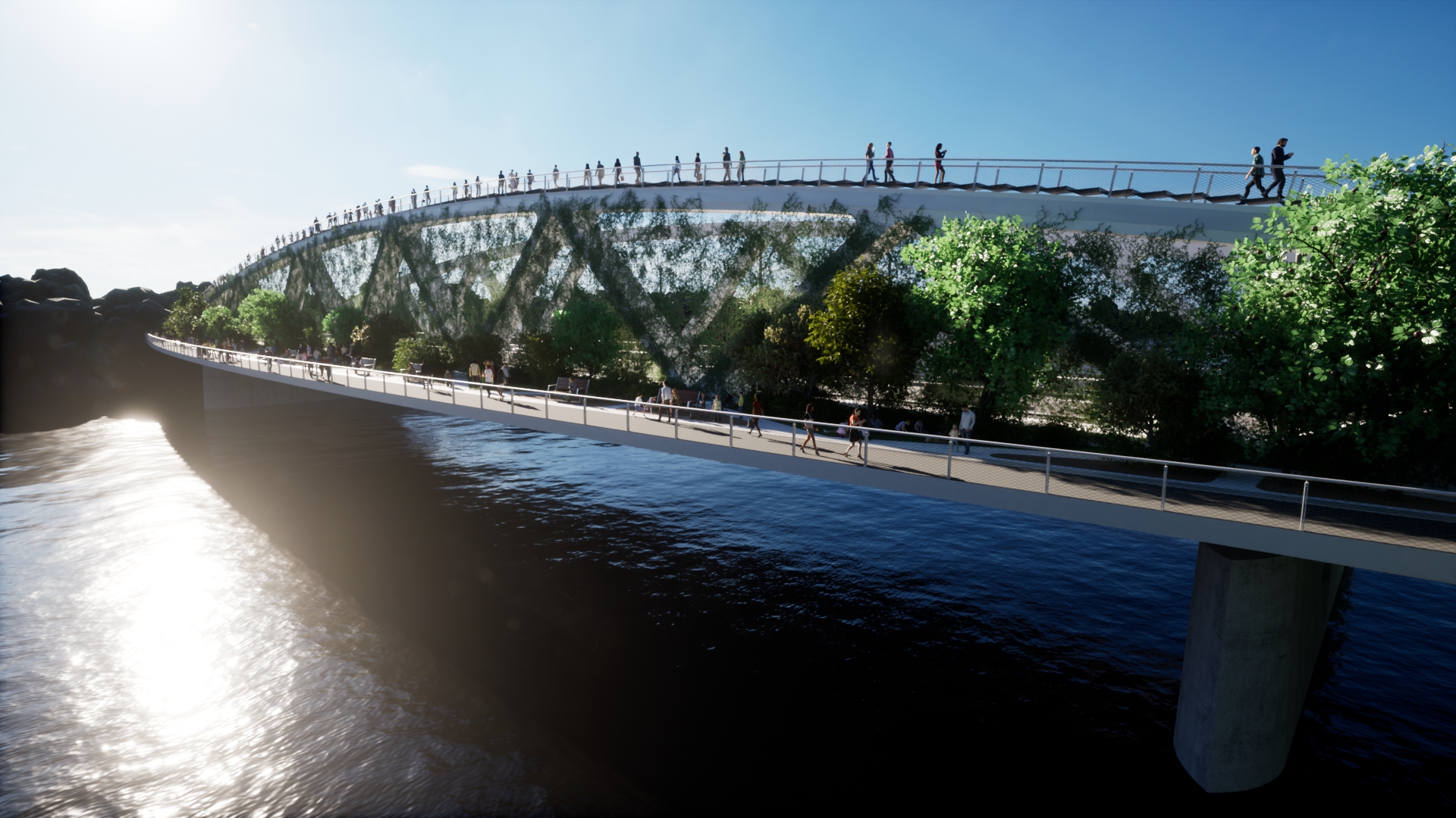
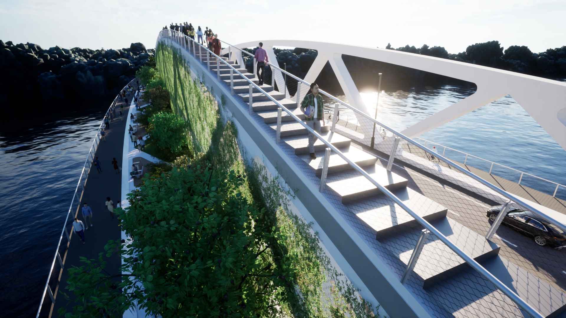
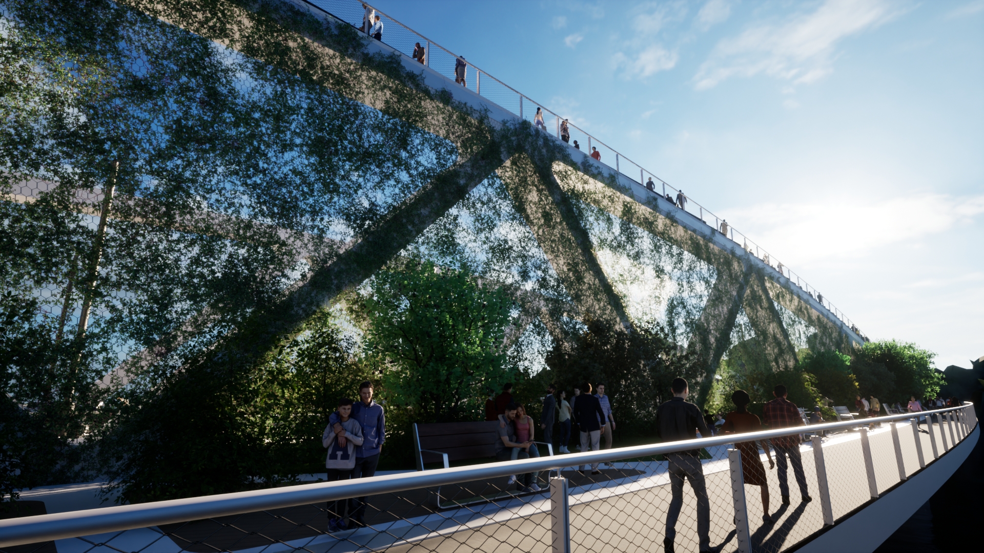
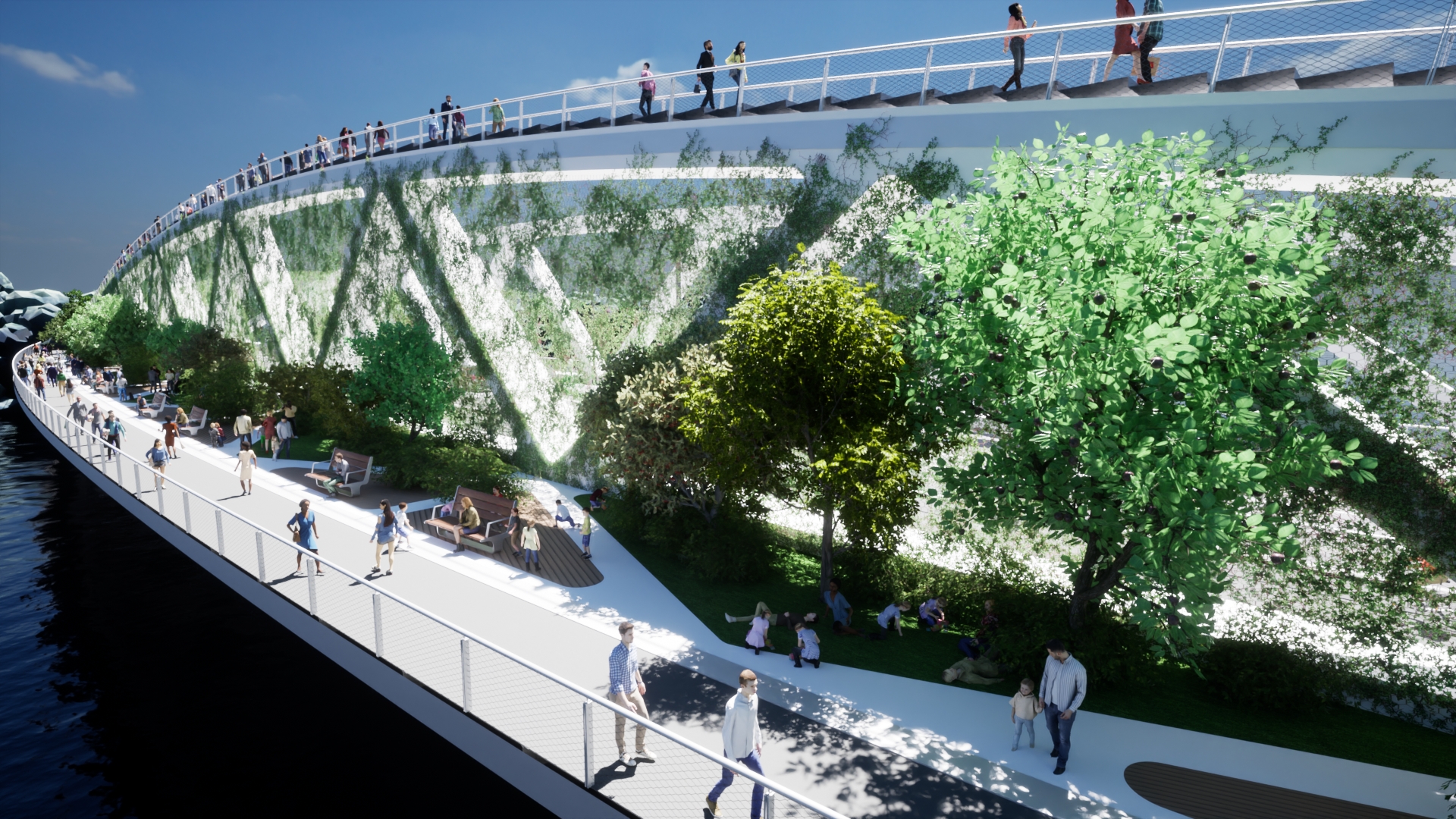
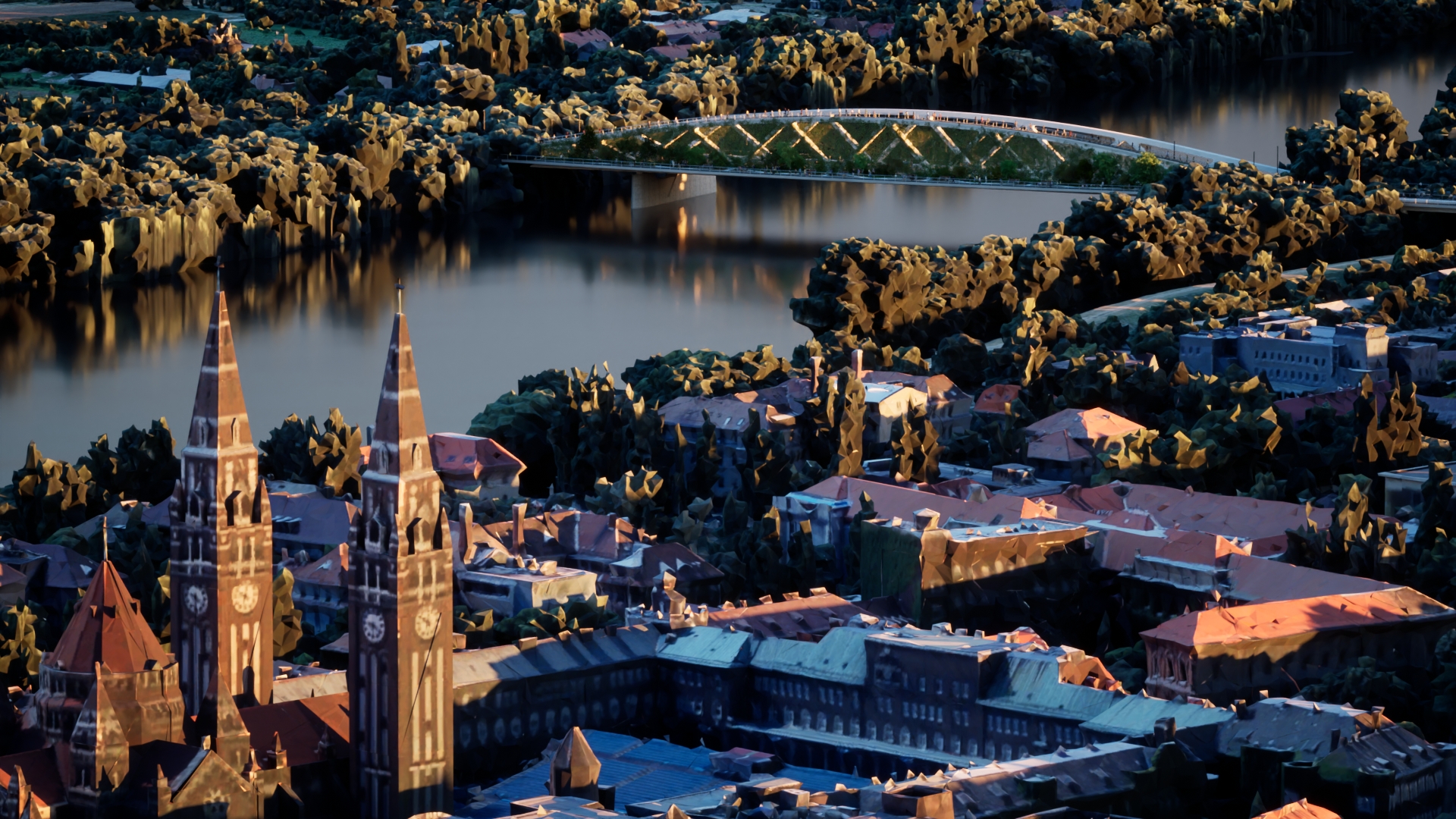
The northern cantilever is 3.0 m wide in the floodplain spans, with a 2.85 m wide footpath. In the connecting riverbed spans, the cantilever increases from 3.0 m to 11.00 m in width, which will contain the footpath and a public space/green area of varying width. The deck is made of steel and covered with 6 mm thick epoxy-embedded aggregate. The slope of the walkway is 2%, outwards. The variable-width northern cantilever, which contains the public spaces and green areas, is created by rotating the vertical Warren truss into a horizontal plane. The cells of the Warren truss, which follow the longitudinal profile of the bridge in a convex curve, are filled with planters and other slabs.
The vertical green surface is formed by a wire mesh stretch on the north side of the vertical Warren truss. The ivy and wild grapevines that will grow on the mesh are planted in horizontal planters. The entire surface of the wire mesh can be covered, except for the triangular ‘gate’ in the middle of the central riverbed span, which serves as a passageway from the bicycle path running between the two main trusses.
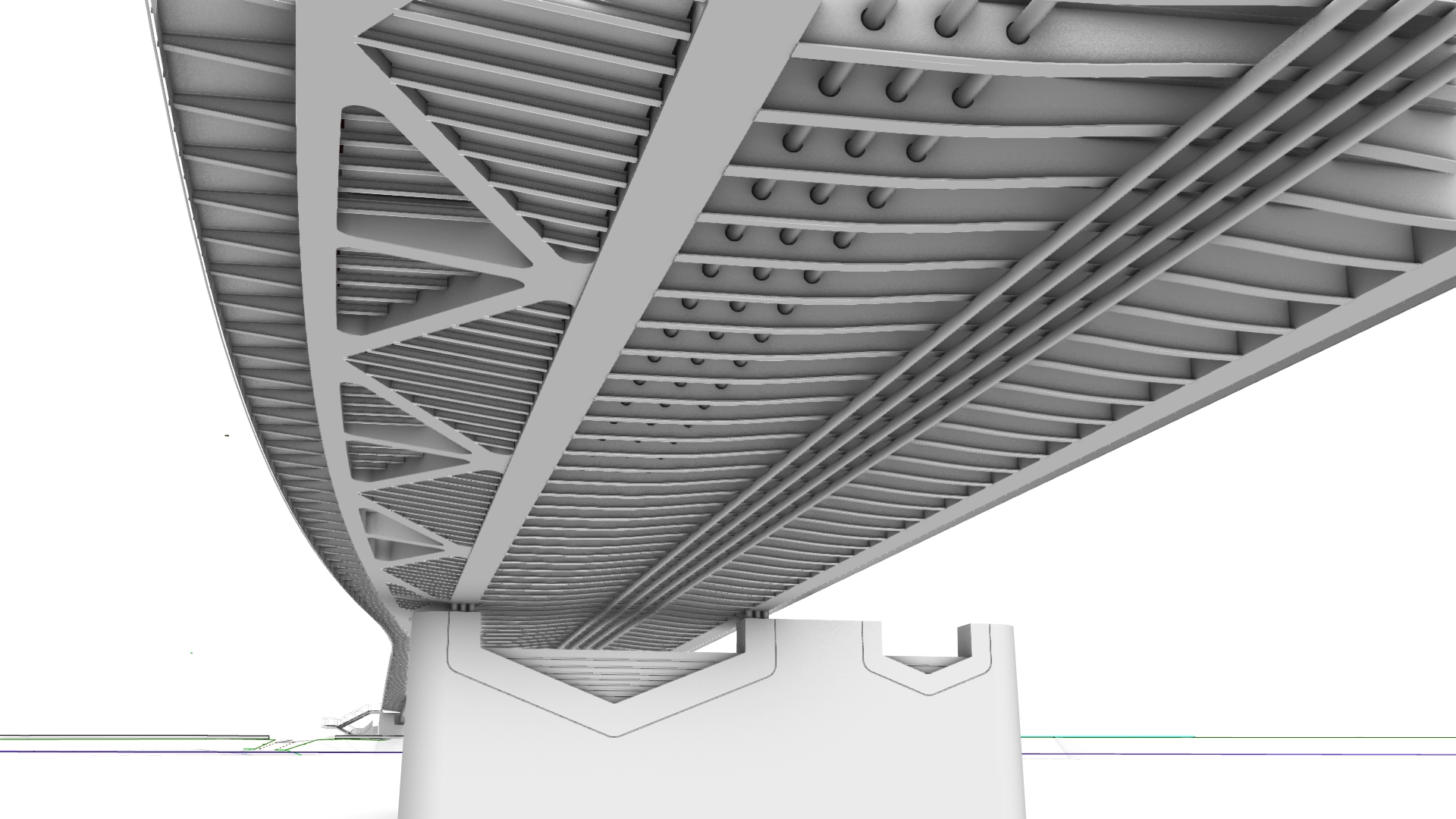
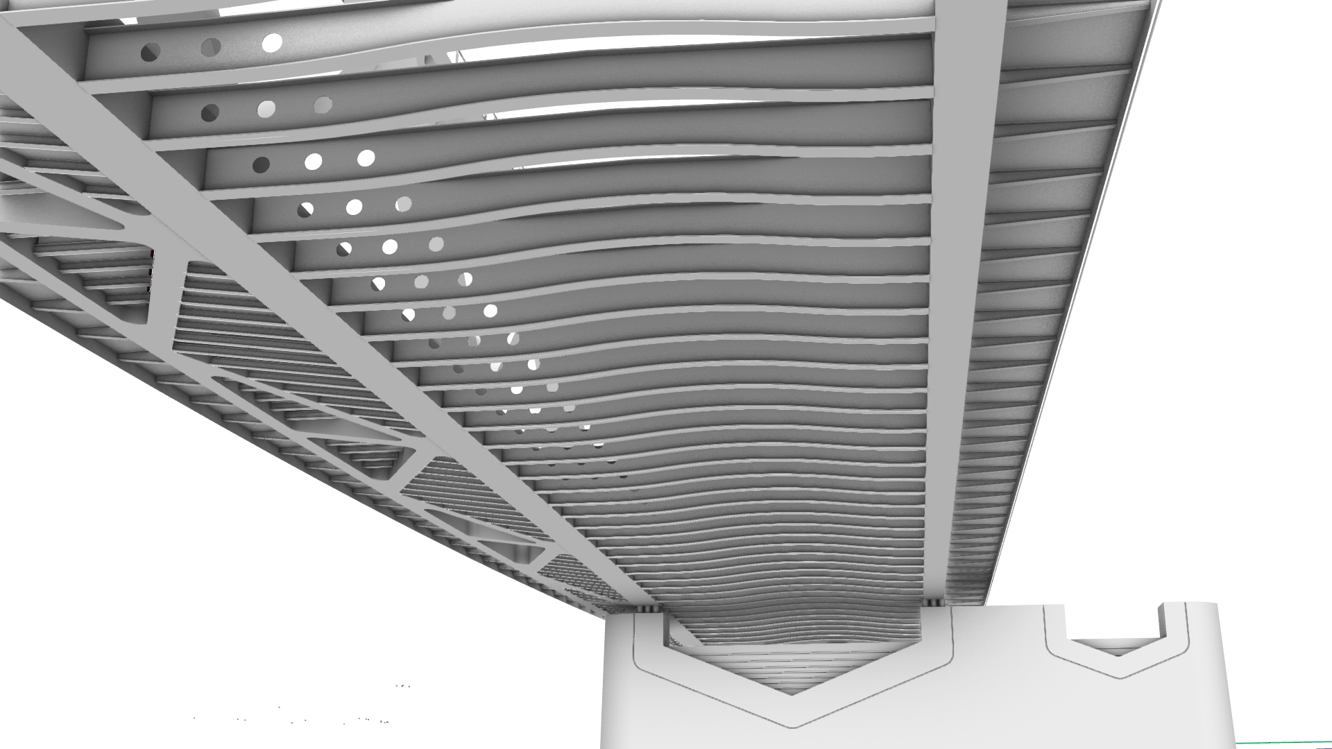
The various functions of the horizontal green areas and public spaces are accommodated in the cells of the horizontal Warren truss of the terrace. The weight of the planters of varying depths, steel decks or glass covers on the surface is distributed evenly by I-girders spaced 1.625 m apart. Under the deeper planters (located in the areas around the supports), the loads are taken up by HEA300 girders, which are positioned at the lower plane of the structure. In the case of steel deck or glass covers, the I-girders are positioned at a height almost equal to the upper plane.
The planters can be made from a variety of materials, ranging from stainless steel to glass fibre reinforced polyester and extruded polypropylene. The primary considerations were low dead-weight, corrosion resistance, road transportability and the inspectability of the adjacent steel structure. The current designs show a steel plate construction reinforced with internal stiffening ribs. The planters have an internal rib-system, so no lateral support is required. Each planter has its own drainage hole in the bottom plate. The dimensions of the planters are determined by the space requirements of the plants and the geometry. Large planters can be divided into several smaller planters. A 10 cm gap must be provided between the side wall of the planter and the steel surfaces of the Warren truss for inspection purposes. The planter rests directly on the I-girders (rubber strips are wedged between the steel surfaces), and these areas can be inspected from below using the inspection platform.
The bridge has two types of decorative lighting, direct and indirect. Direct lighting consists of a narrow LED strip that appears on the bridge edge and the curved upper chord. This type of lighting functions as contour lighting, while indirect lighting is surface lighting that can illuminate the inner surfaces of the otherwise white Warren truss cells.
The construction of Szeged's third (southern) bridge has been on the agenda for a long time, but so far it has not progressed beyond the preliminary design stage. I believe that this unique bridge, with its additional functions, could serve as a good example of how a bridge can function not only as a transport facility but also as a defining central public space for the city. The bridge that will be built as a result of the design is just the tip of the iceberg. The design process is symbolised by the invisible mass of ice beneath the water's surface, which I would like to reveal in the following article.
The position of the southern bridge is largely determined by the route of the Grand Boulevard, so the question that usually arises is whether a purely road bridge or a combined road and railway bridge is needed. To answer this question, it is worth recalling a few relevant events in the city's history in chronological order.
The railway bridge designed by French engineer Ernest Cezanne (1858) was the second steel bridge in the country (after the Széchenyi Chain Bridge) and was located north of the current bridge site. At that time, the city of Szeged had an orthogonal street network. The main railway station functioned as a through station, with the railway line continuing towards Timișoara. The flood of 1879 almost completely washed away the city. During the reconstruction between 1880 and 1883, a new radial-ring city structure was built according to the plans of Lajos Lechner. The first road bridge to be built was the Belvárosi Bridge (1883), designed by János Feketeházy, which was the fifth steel bridge in the country at the time (after the Margit Bridge and the Déli Összekötő Railway Bridge). The elevated railway section close to the city centre did not fit into the urban fabric, as a result of which the southern end of the new grand boulevard (unlike the northern end) did not run all the way to the Tisza River. The Orient Express, which ran between Paris and Constantinople (Istanbul), also crossed the Szeged railway bridge between 1883 and 1920. The Trianon borders, among other things, destroyed the railway network, and then the bombings of World War II sealed the fate of both bridges (1944). The main railway station became a terminus. After the war, a new bridge was built in the city centre (1948), followed by the Bertalan Bridge as the northern crossing of the Grand Boulevard (1979).
Considering the above events, we can make a few observations. The radial-ring road network, which was considered modern at the time, did not precisely mark the final route of the southern end of the grand boulevard due to the existence of the old railway line, and what is worse, no provision was made for its regulation later on, even though the railway lost its significance here after 1944. Currently, several buildings belonging to the University of Szeged (SZTE) are located on the planned route. The railway network has been transformed, with international lines now running between Budapest and Belgrade and Budapest, Szolnok, Arad and Timișoara. The once-prosperous double-track Budapest-Cegléd-Kecskemét-Szeged-Timisoara line certainly no longer plays as significant a role as it did in the past. River freight transport has also lost its importance over time.
The radial-ring urban structure of Szeged has long been operating at suboptimal efficiency, as a very important element is still missing to this day. For more than 70 years, there have been no physical obstacles to regulation, but since all decisions are made in the political arena, the ring road and bridge will only be completed when the ‘stars align’ favourably.
As designers, we may have opinions about many things, but basically, the client sets out their ideas in the design brief, which cannot really be changed afterwards. Design is a long process, so it can happen that the reasons behind the client's initial decisions change during this time. Politics is the art of compromise, which in the right hands can be a creative force. However, compromise and concession are two different concepts. I hope that in this case, compromises have been reached that will result in the project being implemented as soon as possible.
Previously, the idea was to build a separate railway bridge south of the city, but after Romania joined the EU in 2007, the idea of a combined road and railway bridge came to the fore. This idea was based on the fact that EU funds were available for railway bridges at the time, so it seemed cost-effective to use some of these funds to cover the construction of the shared substructure. Currently, main railway stations around the world are being phased out and converted into through stations. In the case of Szeged, there were several alternatives, but the client's decision gave the more prestigious main railway station a new chance to be revived in the future, complemented by the old Timisoara line.
In recent decades, several companies have prepared preliminary designs for the southern bridge (Pontterv, Speciálterv, etc.). When planning purely road connections, they envisioned a cable-stayed bridge, while when the crossing was supplemented with some kind of rail connection, they considered arch bridges. There were examples of shared superstructures and independent superstructures, but in both cases, the reaction forces of the superstructure were transferred to shared substructures.
The public procurement procedure was announced by NIF in 2021 and won by Főmterv. The design process ranged from the decision-making study to the detailed design. The preliminary design study included two independent superstructures on a shared substructure, with two types of riverbed span sizes, one with a 140 m span and one with a 220 m span.
The construction of the southern bridge has been preceded by decades of waiting. Seeing the successive failures of previous plans, the locals have developed a sense of apprehension mixed with anticipation, stemming from the fear that an overly expensive bridge structure could make the project unfeasible. Those who are hopeful envision a low-level, monofunctional road girder bridge with 2x1 lanes, wide sidewalks and not too large spans.
According to the disposition, the basic traffic requirement was to provide 2x2 road lanes, one-way and two-way bicycle lanes and footpaths, supplemented by a railway track running on an independent superstructure. A 75 m wide and 7 m high navigation clearance had to be provided under the bridge, and a 2.5 m high bicycle clearance also had to be passed over the top of the flood protection embankments.
It was important for us that the bridge deck run as low as possible, because this allows for the shortest and lowest connecting embankments. The design of the Szeged side of the Grand Boulevard encountered difficulties because it took up too much space either from the SZTE area north of the road or from the Paprika Zrt. industrial area to the south. Finally, it was possible to locate the junction branch turning off the bridge on the abandoned MÁV areas, which required further compromises with regard to the newly constructed bridge, including lowering the height of the vertical alignment. Another important condition was that it had to be possible to create a direct connection for both the main railway and the tram-train that was acceptable in terms of layout and height, naturally taking into account the navigable clearance and the cycle paths running on top of the flood protection embankments. The end result was that the height difference between the road level measured in the road axis and the lower edge of the structure could only be 2 m, which is a fairly low value given the current span dimensions.
Many people view bridges as monofunctional structures. Far from cities, a motorway bridge, a railway bridge or even a wildlife crossing can be a perfect structure, as it fully satisfies the requirements set for it. In an urban environment, however, it is likely that multiple requirements will be set. Perhaps you don't need to be an urban planner to realise that creating public spaces is a key task in the life of a city. Public spaces can also be created on bridges, and there are quite a few international examples of this, from Paris to Copenhagen, but unfortunately there are not really any such bridges in Hungary. Perhaps the example of the Szabadság Bridge best illustrates the situation in Hungary. As everyone knows, the northern sidewalk of the bridge offers a beautiful panoramic view of the city. In the middle of the bridge, many students and tourists sit down – for lack of anything better – on the bridge structure itself. From spring to autumn, the bridge is almost crowded, which shows that there is a real need for public spaces. It is not uncommon for a bridge to also serve as a viewing platform. Extensions, street furniture, staircases and even glass roof surfaces built on the deck are common.
Prior to this project, I experimented with creating a bridge in an urban space that had additional functions, public spaces, green areas, and a viewing platform. This idea is still quite novel in Hungary, and presumably few people understand its significance. (Those who are interested in more details can learn about the essence of the concept on the blog Pontifex Hungaricus.)
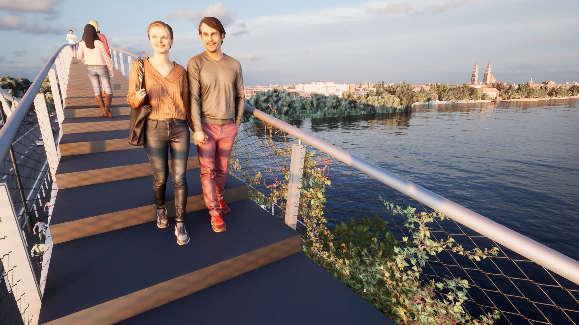
Having familiarised myself with the requirements in Szeged, I attempted to adapt this concept to the bridge location in Szeged, which surprisingly went quickly and easily, because these additional functions were very authentic here. The city supported the lookout function, the wide northern sidewalk with public spaces, and they also liked the horizontal and vertical green areas. Fortunately, I had a free hand, so I was able to tailor this adaptation entirely to local needs and conditions. I designed the shape of the pier pillars so that the underside of the bridge could be serviced by a single inspection platform. I managed to keep the northern sidewalk console conflict-free, meaning that this surface is exclusively for pedestrians. The two-way bicycle lane was placed behind the northern main girder, next to the roadway. We tailored the functions of the public spaces to the needs of the city, but retained the glass ceilings and the recessed planters in the horizontally positioned Warren truss cells, as well as the vertical green surfaces.
There are few known cases where two independent road and rail structures were built in a uniform style on a shared or separate substructure. It was important to me that the road and rail structures had a uniform appearance, so it is no coincidence that the main girders of the railway bridge have the same dimensions and layout as the southern main girder of the road bridge. It was also important that every single structure in the neighbourhood of the river bridge (retaining wall, stairs, pedestrian underpass) should appear in the same style, so that the end result would present a completely uniform image. The design of the pedestrian underpasses also matches that of the river bridge. The uniform design language, the uniform use of materials and colours, the uniform structural solutions, the uniform railing design, and the uniform street and decorative lighting are all important parts of the concept. A better alternative to guardrails was also found in the form of a raised safety kerb.
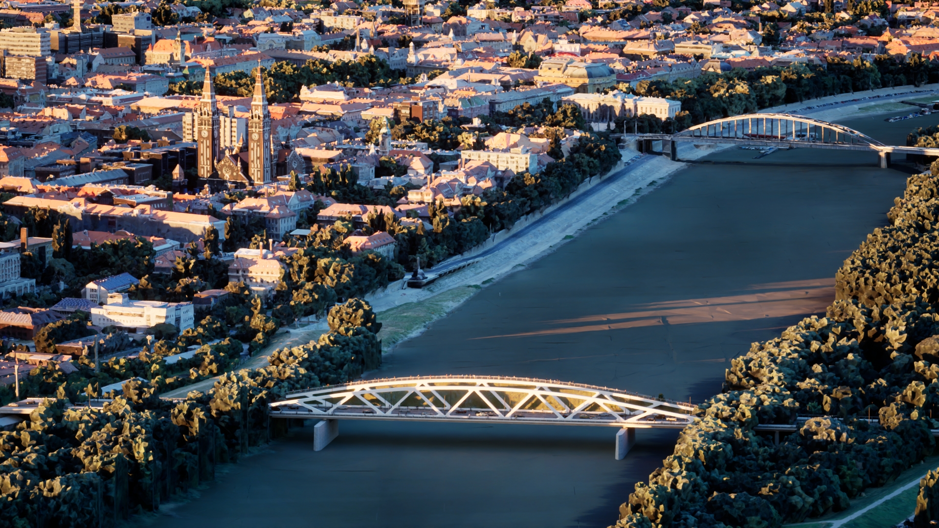
This bridge does not attempt to break any records with its dimensions, but simply aims to satisfy as many local needs as possible. The curved shape of the bridge blends perfectly into the landscape of the Great Plain, so it does not compete in any way with the tall twin towers of the Szeged Cathedral. Instead of uncomfortably long, narrow and noisy footpaths, there is a wide, protected, conflict-free pedestrian zone, physically separated by a curved Warren truss in the middle, where the walk across the bridge can be interrupted every 150-200 metres. The separate, intimate spaces, the closeness of the water and the shade-providing plants, the richness of detail adapted to the speed of the pedestrians are all details that many people do not yet notice, but I am convinced that this kind of luxury is not only the privilege of citizens of countries further west of us. (Essentially, the aim of the course I teach at BME, Aesthetics of Bridge Structures, is to familiarise students with such small details). To increase the local ‘embeddedness’ and authenticity of the bridge, I carried over the design of the floodplain piers of the Bertalan Bridge and the mass formation of its massive abutments. Many criticisms can be made, but a main girder that also functions as a lookout platform, together with its staircases and railings, does not represent a significant additional cost, just as the horizontal and vertical green surfaces are more spectacular than costly. References to carbon footprints or greenwashing can easily mislead the discourse, which is why it is worth clarifying the concepts first.
This is my first bridge that has additional functions and is based on a real order. The ideas I presented in the Chameleon Bridge project have now been realised here. It was an exciting task to treat the various connecting structures as a complex, to design them uniformly and to express them in the same style, which was unprecedented within the company. The responsibility for design, which was reduced almost exclusively to technical issues, was acceptable, and in fact, that is what makes it worthwhile. Fortunately, the role of project manager, which involved coordinating many different disciplines and conducting various consultations, did not fall to me.
I have no illusions about the project being realised; under the current circumstances, the chances of it happening are very slim. A signed contract must be fulfilled, no matter how events unfold along the way. During the project, skyrocketing inflation devalued the already low contract price, so it is understandable that the project turned out to be bittersweet from the company's point of view. Of course, even abstracting from financial considerations, there are problems that can only be addressed through structural change. Hopefully, others within the company will recognise this, and at least this much will come out of this trial of strength.
I greatly appreciate the city's decision-makers for taking on this bridge, which features public spaces, viewing platforms and green areas, and for standing by it. The bridge will be managed/operated by the city, so it is essential that it meets their needs to the fullest extent possible. We have also experienced openness on the part of ÉKM (Ministry of Construction and Transport), so I would like to thank them for their valuable work on the project. Thanks are due to every single colleague who has made a meaningful contribution to the completion of the plans.
Even by the most cautious estimates, it will take at least 8-10 years (2033-2035) for the project to be realised.
CLIENT: ÉKM (Ministry of Construction and Transport)
DESIGNERS: Főmterv Zrt. (BIM, traffic engineering, geotechnics, bridge engineering, organisation, roads, railways, hydraulic engineering), project manager: Tamás Németh; main subdesigners: decorative lighting (Lisys-Projekt), independent structural calculations (BME HSZT), navigation signals (Gyula Récsey), bridge monitoring (BME HSZT), telecommunications networks (HHT’98), environmental protection (Vibrocomp), public utility planning (TSPC), street lighting, electrical networks (HIRVILL), irrigation system (András Zöllei), platform architecture (MATA-DÓR Architektúra), landscape architecture (4D Tájépítész Iroda, Fontos Mérnök Stúdió), inspection platform (Tibor Bíró).
| location: | Szeged, Hungary |
| crossed obstacle: | Tisza River |
| type: | multi-span girder bridge |
| function: | road bridge with additional functions |
| client: | Ministry of Construction and Transport |
| bridge engineer: | Főmterv Zrt. |
| role in design: | responsible for conceptual, structural and detailed design |
| study: | 2021-2024 |
| execution: | |
| overall length: | 395 m |
| main span: | 130 m |
| links: | Pontifex Hungaricus - Cameleon Bridge |
| Article Telex - 2022 | |
| Bridge Conference 2024 - presentation in Hungarian (mp4) | |
| Transport development in Hungary Conference 2025 - presentation | |
| downloadable pdf: | Bridge Conference 2024 - presentation (pdf) |
| Article of Engineering Journal 2025 (pdf) | |
| renders: | Attila Vigh |